| ˇˇ
Grand Circle Winter
Trip
12/4 - 12/14, 2013 We
had a winter trip with my sister Dong-Hyun from Korea as the map shown
below. I have never traveled in winter as the road condition might be very
poor due to the snow, but it was inevitable this time as she came from Korea
in winter. As it is still early December, I thought there would not be much
chances of snow and it would be light snow if there are any. Besides, we
will be traveling southwest desert states which would not have too much
chances of snow in the early December anyway. I
worried slippery road by snow and thought about snow tires and chains.
However, as the chances are not too high in early December, I decided I will
buy chains on the road, if required. I
didn't think about other real problems other than slippery road - high
altitute and cold weather, however. High
Altitute,
higher than 6,000 ft at other than L. A. and Las Vegas caused severe short
breath to me, a lot more than I expected. In addition, unusually
very cold weather
all over the U.S.A. during our trip gave us extreme hardship to me
especially, because I have to smoke at outside, especially in the night. The
temperature has been below freezing point always, day or night, and it was
-10F (= -23C) at one point, at Bryce Canyon.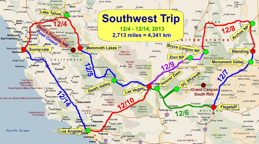
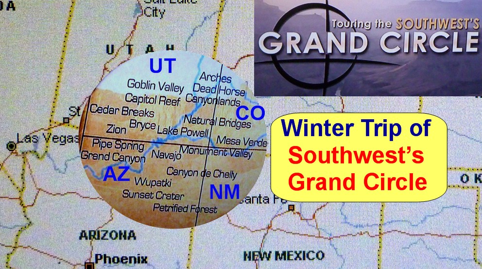
The wide circle shown below at the juction of Utah, Arizona, Colorado and
New Mexico is called Grand Circle of Southwest,
as there are more national parks, state parks, national monuments etc. etc.
than any other place in U.S.A. and we traveled this area
this time.
Day-1
12/4
We left home on 12/4 and drove to Mammoth Lakes
through Lake Tahoe. There was a snow on Siera Mountains on 12/3 but the snow
on Highway 50 and Highway 395 was all melt already except in shade
areas and there was not much driving difficulties.
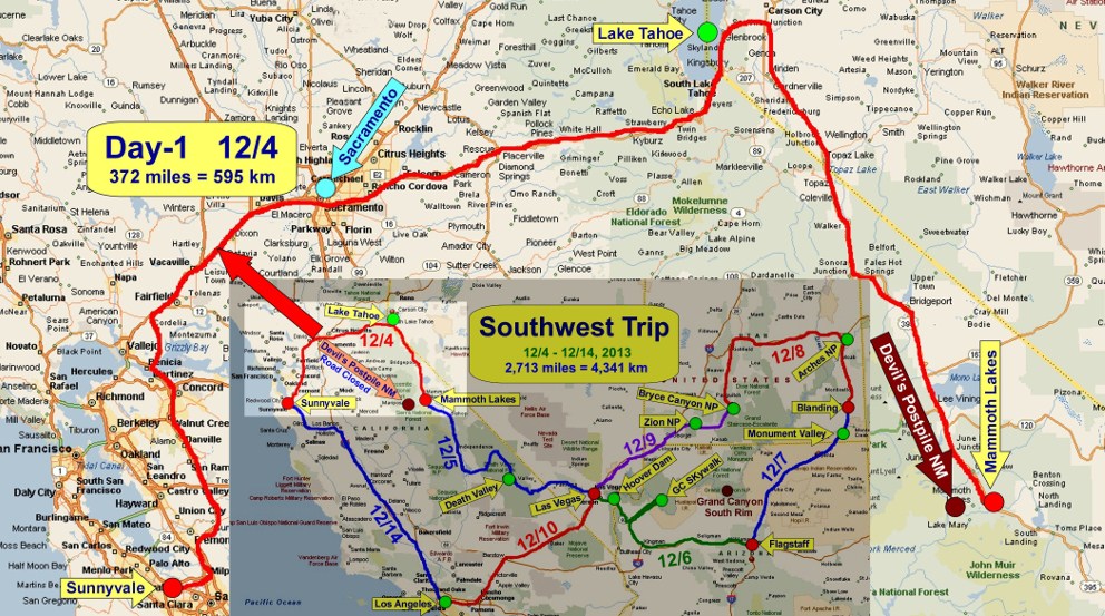
Road
was clear but the snow one day earlier created very beutiful snow scenery on
HWY-50 to Lake Tahoe.
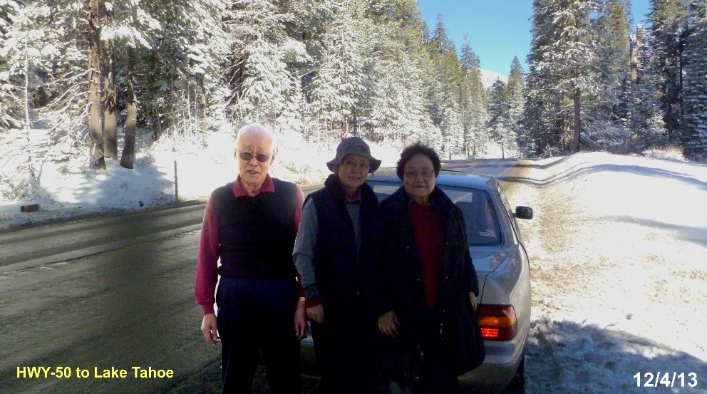
The
beautiful snow scene of Lake Tahoe has amazed my sister very much.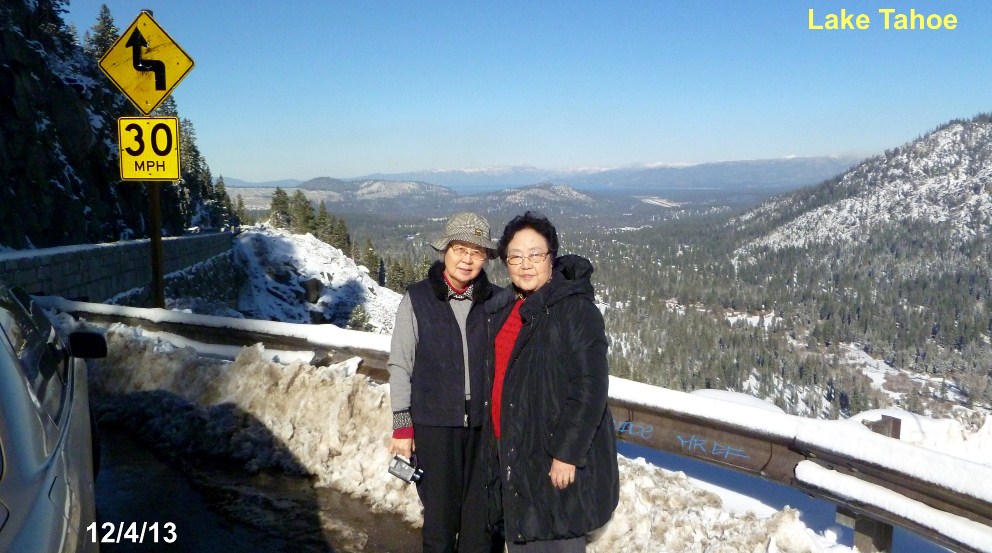 Day-2
12/5
Mammoth
Lakes was 7,200 ft above sea level and I have experienced very severe short
breath problem.
Besides, temperature dropped to 0F (-18C) in the night. The cold weather
problem started from here.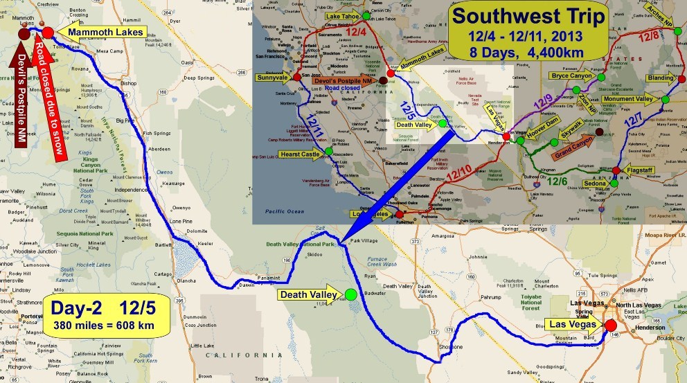
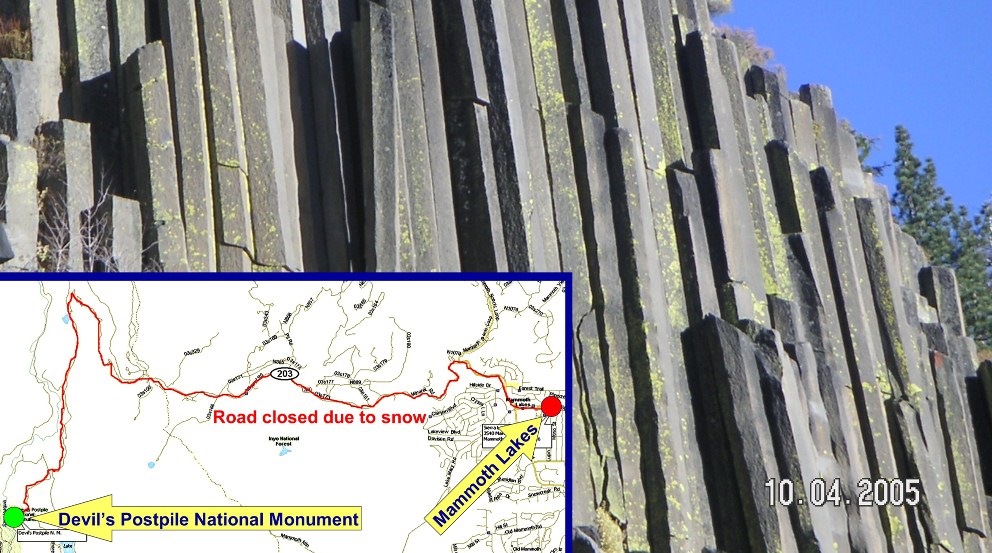
I have
planned to visit Devel's Postpile Monument next morning before we head for
Death Valley. But the road to the monument was closed already due to snow
and we had to give up the visit to the monument.
HWY-395 was very foggy in the
morning but we arrived Death Valley at around noon time safely.
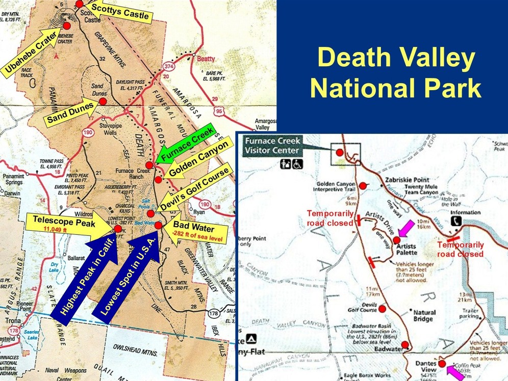
It is the first time to see this sign of the Death Valley National Park. (It
has never been there.)
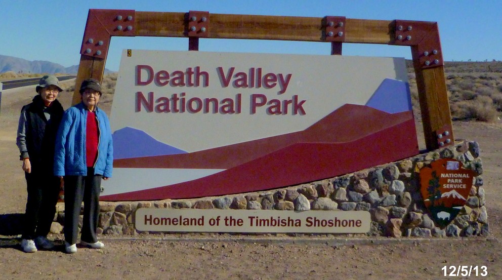
Now is the season
of the Death Valley. As it is very hot in summer, all restaurants and gas
stations are closed in summer. There are many interesting places in Death
Valley such as Telescope Peak of 11,049 ft, the highest point in California,
and Bad Water of 282 ft below sea level, the lowest point in U.S.A., very
close.
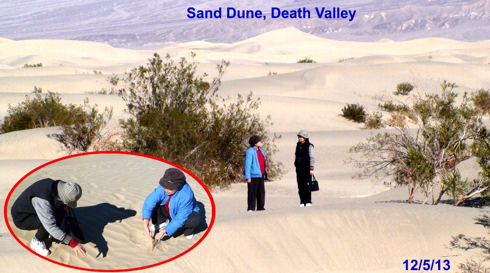
Beautiful
Sand Dune of the Death Valley.
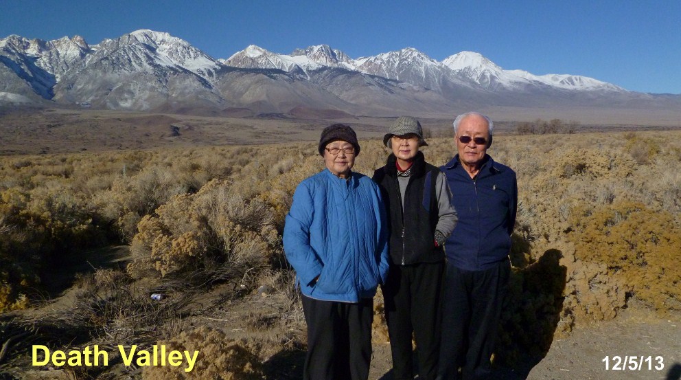
Another
scene of the Death Valley.
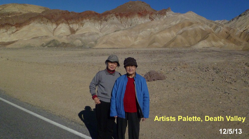
The
surface of this Artists Palette looks very smooth, just like painted with
various colors of paints
I
am not sure why this field is called Golf Course. It is extremely hard
salts, harder than rocks.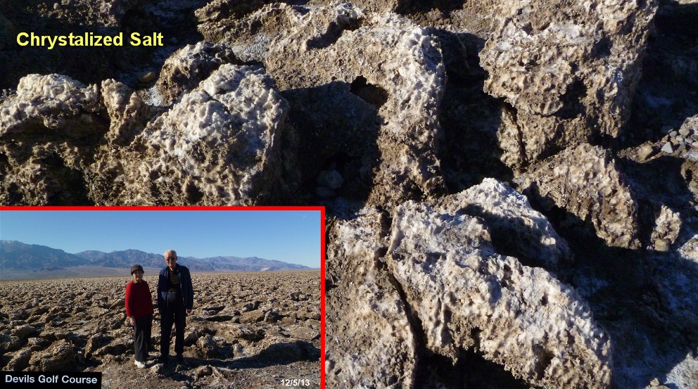
The lowest point
in U.S.A. (in the world?) - 282 ft below Sea Level.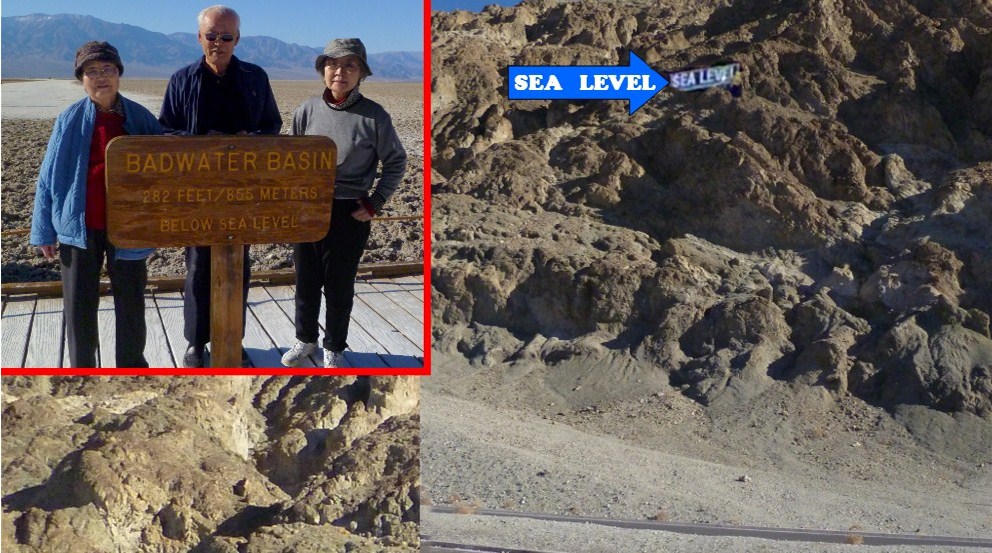
ˇˇ
|